Introduction to innovative weather drone technology
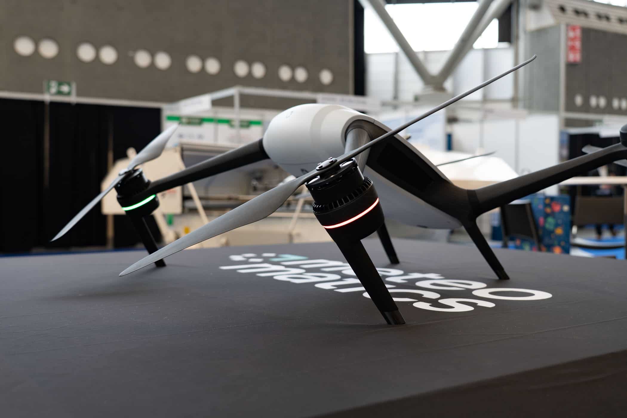
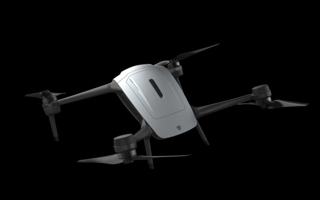
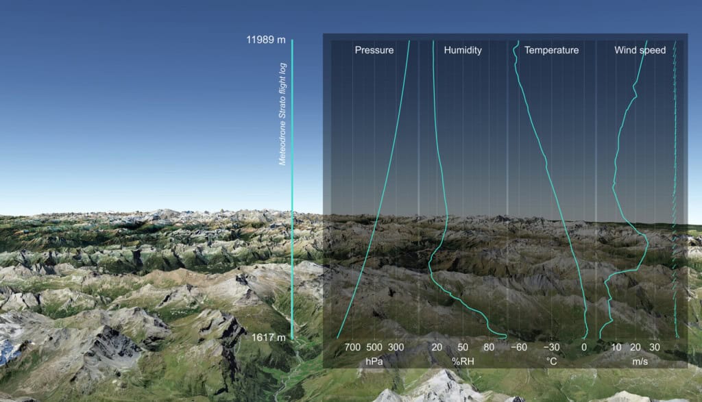
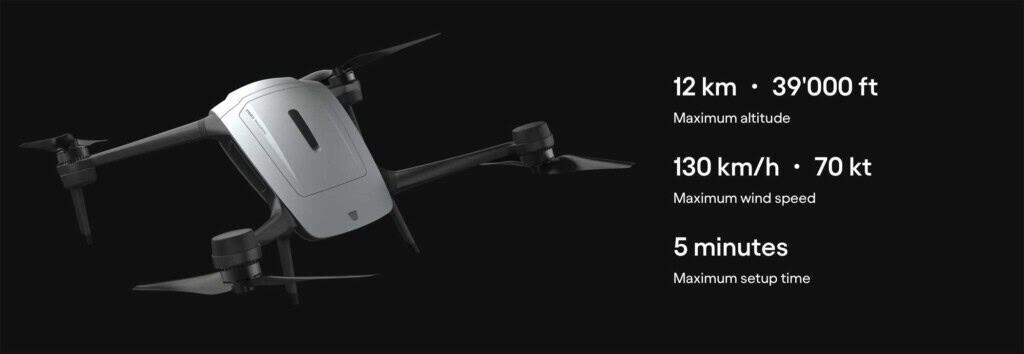
In the field of meteorology, precise and comprehensive data are crucial for enabling more accurate weather forecasts. The latest generation of weather drones – exemplified by the Strato model from Meteomatics – marks a significant advancement in the collection of atmospheric data. Capable of reaching altitudes of up to 12 kilometers, this system sets new standards for vertical atmospheric measurements. This greatly increased flight altitude allows for the capture of vertical atmospheric profiles in greater detail and with unprecedented resolution. Strato thus expands the range of meteorological measurement methods, which until now had been dominated primarily by radiosondes ascending into the stratosphere via weather balloons.


Limitations of existing meteorological technologies and the contribution of modern drones
Collecting vertical measurements – such as temperature, humidity, air pressure, and wind speed – is crucial for a sound understanding of meteorological processes in the lower and middle atmosphere. However, traditional instruments, particularly weather balloons carrying radiosondes, face certain limitations: in many regions, for instance, they are deployed only once or twice a day, which restricts the temporal resolution of the data. Furthermore, the loss of weather balloons after flight is a recurring issue that limits reusability and consequently drives up costs. New autonomous weather drones offer an innovative alternative, significantly expanding the data pool through more frequent – and, above all, continuous – measurements. Strato can relaunch immediately after charging and continuously captures high-resolution measurement data, enabling a significant… Increasing the availability and quality of weather data.
Dr. Martin Fengler, founder of Meteomatics, highlights the new possibilities offered by Strato: the availability of additional atmospheric observation data from altitudes that were previously difficult to access will help refine meteorological models and improve the forecasting of local weather events. This precise and extensive atmospheric data is essential for accurately capturing and modeling weather phenomena – which are becoming more frequent and dynamic, particularly in the era of climate change.
Meteomatics’ comprehensive meteorological technology portfolio
With its technology platform, Meteomatics offers not only innovative devices for data acquisition but also powerful tools for analyzing and utilizing that data. Alongside the Meteodrones, which optimize the data collection process, the numerical weather models EURO1k and US1k play a pivotal role. These models provide weather forecasts with a horizontal resolution of one kilometer, enabling hyper-local data for a wide range of applications. Users – particularly in regions where local weather phenomena occur – benefit significantly from this enhanced model resolution, as conventional models often fail to achieve such levels of detail.
The Meteomatics Weather API facilitates access to a wide range of high-resolution weather parameters. This enables companies and organizations to quickly access up-to-date weather information that is crucial for operational decision-making. This ecosystem is complemented by MetX, a platform for the systematic visualization, analysis, and utilization of meteorological data in an operational context. Furthermore, the integration of artificial intelligence into the system enhances the usability of complex weather information and supports users in making data-driven decisions.
The interplay of all platform components – data acquisition, modeling, data provision, and analysis – creates a comprehensive solution that contributes most significantly to the precision of modern weather forecasts. This helps mitigate risks in sectors such as aviation and agriculture while simultaneously enhancing the efficiency of energy production and reducing costs.
Practical Application and Future Prospects
Strato’s ability to reach altitudes of up to 12 km while continuously measuring atmospheric profiles opens up new possibilities for research institutions, national weather services, and companies across a wide range of industries. For instance, the precise measurement of wind speeds and temperature distributions at high altitudes can help improve air traffic safety. Similarly, users in the agricultural sector benefit from more accurate forecasts when planning sowing, harvesting, and crop protection measures.
The energy sector, too, can operate wind and solar power plants more effectively – and thereby enhance grid stability – by leveraging precise weather models and real-time data streams. The opportunity to experience the potential of Strato firsthand through live demonstrations and direct dialogue with experts at events such as the Meteorological Technology World Expo 2026 underscores the technology’s relevance for practical application.
Moreover, the sustainable development and ongoing evolution of this generation of weather drones demonstrate the high priority placed on continuously improving meteorological data collection and analysis within both research and industry. This new generation of weather drones thus makes a significant contribution to adapting to the challenges of climate change and minimizing the associated risks.
Conclusion
The presentation of the Strato weather drone highlights the possibilities modern technology offers to elevate meteorological data collection to a new level. With an unprecedented flight altitude of up to 12 kilometers and continuous vertical measurement of temperature, humidity, air pressure, and wind, Strato significantly extends the capabilities of traditional meteorological instruments. Combined with advanced weather models, efficient data delivery via APIs, and AI-assisted analysis, this creates a powerful platform that enables precise and timely weather forecasting. These developments not only contribute to scientific research but also hold great practical relevance across many economic sectors.
The innovative Strato weather drone impressively demonstrates how technological advances and the intelligent integration of measurement and analysis methods can sustainably enhance forecast accuracy and safety across numerous fields of application. The improved availability and quality of meteorological data make a significant contribution to adapting to global climate change.