This site is also available on:
Deutsch
Introduction to the importance of sea surface monitoring
Monitoring sea level is becoming increasingly important as the climate crisis progresses and sea levels rise globally. Continuous and precise measurement of the ocean surface is essential for a better understanding of ocean changes and for analyzing their impact on the global climate and coastal regions. Satellites like Sentinel-6B make a crucial contribution by collecting highly accurate data, thereby complementing and refining established climate models.
Technological achievements and function of the satellite
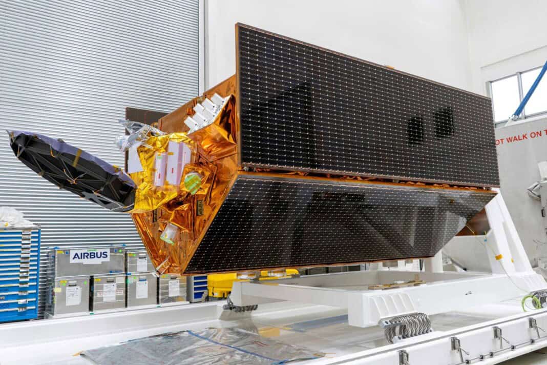
Sentinel-6B, developed by Airbus, sets new standards in satellite-based sea surface measurement. The satellite is in a non-sun-synchronous orbit at an altitude of approximately 1,336 kilometers, orbiting the Earth at an angle of 66 degrees. This specific orbit allows it to fly over different geographical regions at various times of day and night. This enables precise recording of diurnal variations and tides, and allows for faster identification of changes in sea level curves.
The satellite’s core component is a radar altimeter that transmits electromagnetic waves in the form of radar pulses to the sea surface. The time it takes for the pulses to return is precisely measured, allowing conclusions to be drawn about the exact sea level. The accuracy of these measurements is in the centimeter range. This data enables the tracking of current trends in sea-level rise as well as short-term oscillations in sea surface topography. Furthermore, Sentinel-6B’s instruments gather additional information on atmospheric parameters such as temperature and humidity profiles in the vertical direction, providing a holistic view of the oceanic and atmospheric systems.
Significance of the mission for climate research and environmental protection
Providing reliable and precise sea level data is an essential component of climate research. Global sea level rise is one of the most dramatic consequences of global warming. The thermal expansion resulting from the increase in ocean volume due to warming, as well as the melting of ice sheets, leads to increasing risks for coastlines and adjacent communities. Sentinel-6B ensures that the long-term measurement series, which form the basis for climate models and adaptation strategies, are continuously updated and expanded. This data foundation is an indispensable prerequisite for developing effective measures to reduce climate risks and for providing a sound basis for policy decisions.
Satellite data also serves to improve the forecasting of weather phenomena and ocean currents, which has a positive impact on shipping, fishing, and disaster relief. Reliable information about sea levels is particularly crucial during storm surges or floods, enabling early warnings and the initiation of evacuation measures.
Cooperation and global significance of the Sentinel-6 mission
The Sentinel-6 mission is not only of technical importance, but also a prime example of international cooperation in addressing global environmental issues. Developed within the framework of the European Union’s Copernicus Programme, the mission collaborates with international partners such as NASA, ESA, EUMETSAT, NOAA, and CNES. This cooperation enables the pooling of expertise, resources, and technological innovations, and guarantees comprehensive analysis and availability of the collected data for the global scientific community.
Airbus, acting as prime contractor, has once again demonstrated its expertise in satellite technology with the development of Sentinel-6B. Sentinel-6 is part of a larger portfolio of over twenty climate monitoring missions being delivered under Airbus’s leadership. This infrastructure supports global efforts to protect the planet by continuously contributing to the documentation and understanding of climate change.
Outlook and long-term prospects
With the commissioning of Sentinel-6B, continuous data acquisition on sea level changes will be guaranteed for at least a decade, which is invaluable for climate research. The ability to simultaneously conduct comparable measurements with two identical satellites, such as Sentinel-6 Michael Freilich and Sentinel-6B, increases data quality and reduces uncertainties. This strategy makes it possible to detect even minor changes in global sea level more reliably and quickly.
Future technologies will build upon this, linking this data with other climate observations such as ice cover, sea temperatures, and atmospheric measurements to establish a comprehensive system for sustainable environmental monitoring. Sentinel-6B is therefore not only a technological masterpiece of its time, but also a crucial component in the global response to the challenges of climate change and environmental protection.
Conclusion: Future changes can be predicted precisely.
The advanced sea-level measurement provided by Sentinel-6B is a key instrument for objectively recording global sea-level rise in recent years and accurately predicting future changes. By combining state-of-the-art satellite technology with international partnerships, long-term monitoring is ensured, which significantly supports the protection of vulnerable coastal regions and provides valuable data for weather forecasting and climate models.
By understanding and utilizing this data, they contribute to the increasingly effective development and global implementation of strategies to combat the consequences of climate change. The Sentinel-6 mission exemplifies the close link between technological progress, scientific research, and societal benefit at a time when preserving our planet is more urgent than ever.


